


Where is Amherst County?
1 Day Drive to all Major Metropolitan Areas on the East Coast
Hover over the state of VA to see a close-up of Amherst County.
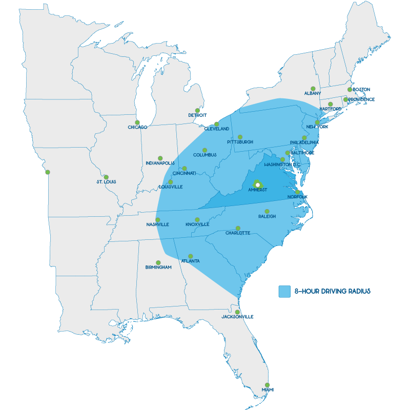
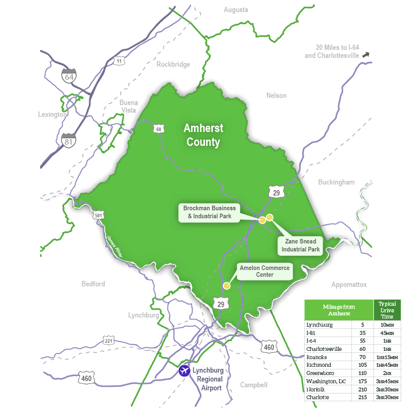
Hover over the state of VA to see a close-up of Amherst County.

328 Richmond Highway, VA 24521 | Phone: 434-946-5200
© 2026 Economic Development Authority of Amherst County
Graded and permitted for fast-track expansion to 65,000 sq. ft.
Conference room/break room, equipped with countertop, sink, refrigeration, and A/V connections.
Loading dock area features 14×14′ drive-in door, plus an 8’x10′ roll-up bay door. Engineered for 3 additional drive-in doors and 1 additional loading dock.
Approximately 15,000 sq. ft. production floorspace with 36′ clear ceilings and shipping areas, ready to be put to use for production or distribution.
Restroom area for production personnel is also equipped with a safety eye-wash station and stainless-steel wash fountain.
Separate entrance into vestibule with two restrooms, and doorway into conference room. Equipped with countertop, sink, refrigeration, and A/V connections.
Approx. 30,000 sq. ft. flex space with 36′ clear ceiling, accessible through multiple external doorways. Floor ready to be finished per user requirements.